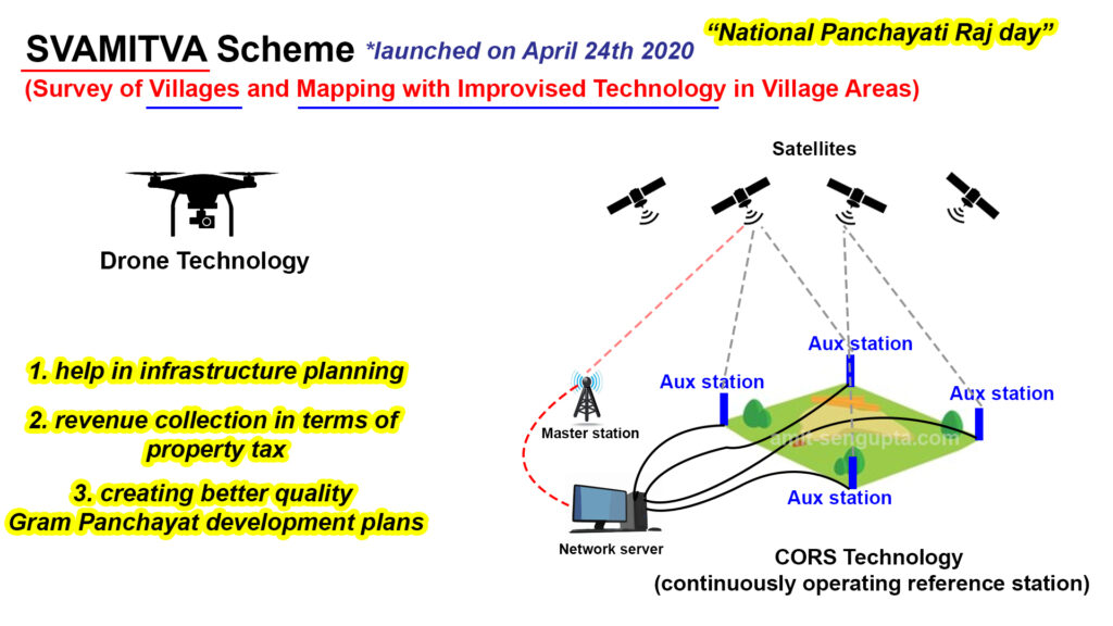
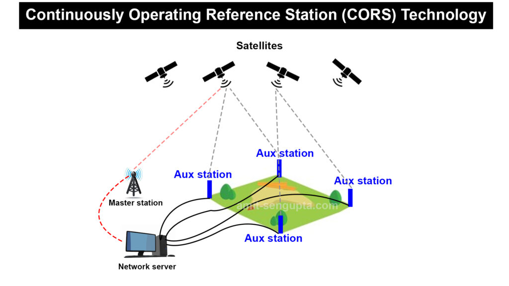
Government of India maps land blocks both in rural and urban areas by using Drone technology and CORS Technology (continuously operating reference station). Continuously Operating Reference System (CORS) is an infrastructure that can solve the problem of accuracy and real-time data acquisition. Looking at the importance and usefulness of this technology, the Survey of India has started an initiative of establishing a nationwide CORS network.
Now, the question is ‘How will the Government of India benefit from it?’ It will help the govt in infrastructure planning, then revenue collection in terms of property tax, then it will help in creating better quality Gram Panchayat development plans.
Just imagine when you have a proper map of a particular location then it helps in building Infrastructures for economic development. With the help of Gram Panchayat development plans, there will be economic development as well as social development in rural areas. That is how everything is connected one after another.
This technology is being used for implementing SVAMITVA scheme. The full form of SVAMITVA is (Survey of Villages and Mapping with Improvised Technology in Village Areas). It was launched on April 24th 2020 during National Panchayati Raj day. In the beginning, this program was only functioning in 6 States – Haryana, Karnataka, Madhya Pradesh, Maharashtra, Uttar Pradesh and Uttarakhand. Now the Government of India is saying that it is going to extend the scheme to all states and union territories of India.